
|
|
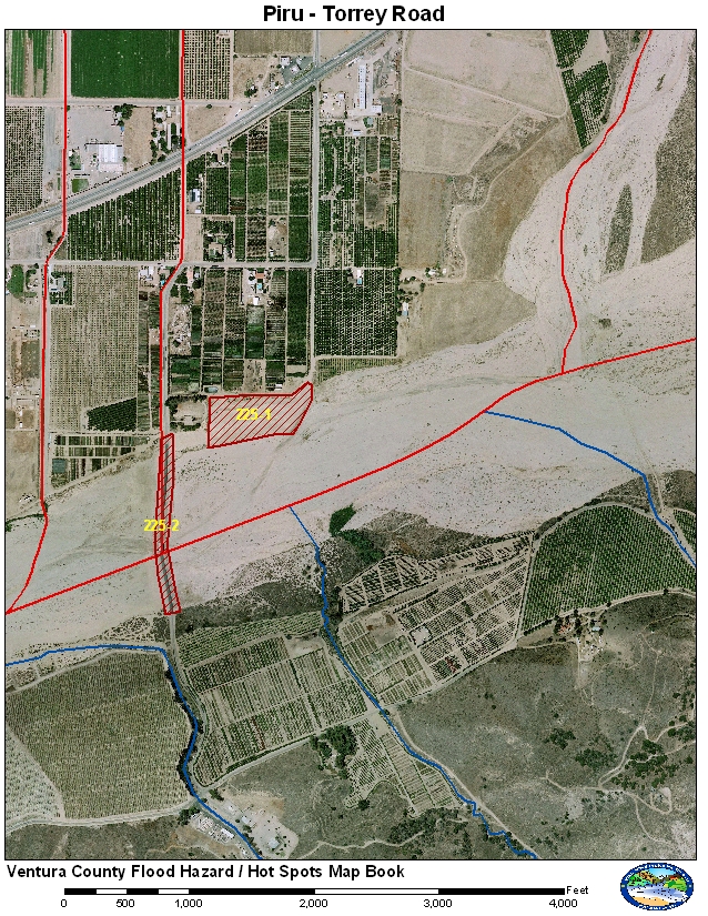
Ventura County
|
225-1 Old Piru Landfill
225-2 Torrey Road Bridge
Torrey Road Bridge is a small bridge that allows for vehicles to cross the river during dry and small to moderate storms. During larger storms the approaches act to move the water to the center of the channel. During the major events, 10-year or larger, the approaches can get washed out. The old Piru Landfill was not next to the river but the river has migrated to the old site.
Historical Data
Torrey Road approaches were washed out Jan 1995, March 1995, 1998, and Jan 2005. In 1996 the approaches were damaged but not completely washed out. The Old Piru Landfill was damaged in Jan 2005. The main channel of the Santa Clara River has moved north and is along the bank that protects the old landfill.
Aerial Photo and Map
Photos of Area
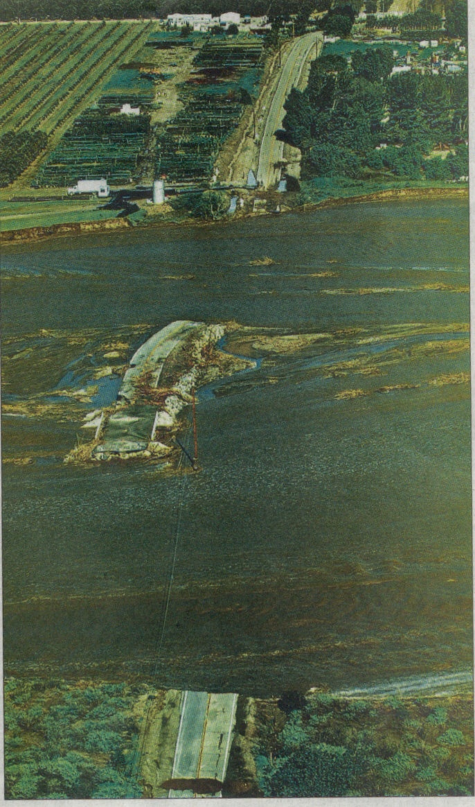
Torrey Road washout Jan 10, 2005. Ventura
County Star photo.
Gages
A combination of gages have to be used to determine the flow at Torrey Road Bridge. The USGS operates a gage upstream at the Newhall Ranch Bridge. The rating at this site can become questionable due to changes in vegetation and channel changes due to erosion and deposition. The second gage is the reservoir level and spillway rating for Santa Felicia Dam.
Normal Conditions Procedure
Gages Used: 707a, 792
|
Criteria |
Value |
Issue |
Area |
Procedure |
|
Flow |
8,000 cfs |
Erosion |
225-1 |
Watch for erosion along Old Piru Dump |
|
Flow |
10,000 cfs |
Erosion and Flooding |
225-2 |
Watch for erosion and flooding of Torrey Road approaches. |
|
Flow |
12,00 cfs |
Erosion and Flooding |
225-2 |
Warning for potential erosion and flooding of Torrey Road approaches. PWA-Raods to onsider road closure. |
|
Flow |
15,000 cfs |
Erosion and Flooding |
225-2 |
Torrey Road approaches may be compromised. Road should be closed |
| Flow | 30,000 cfs | Flooding and Damage | 225-2 | Water should be flowing over the Torrey Raod Bridge. Bridge may be damaged. |
Data collected information provided by PWA-Raods and flow data from the USGS.