
|
|
Ventura County
|
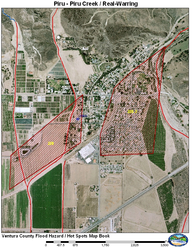
220-2 Piru Creek at Railroad - Town of Piru
228 - Real-Warring Drain above Railroad
Piru Creek can flood the town of Piru during a very large release or a major release with debris. Piru Creek makes a 90 degree bend as it enters the town. There has been a history of erosion at the bend. A bank stabilization project was constructed in 2008. Warring may flood if debris is present and get caught on bridges and upstream debris basin is full.
Historical Data
No recent history of flooding although there was significant debris on the railroad bridge after February 1998. Warring had previous flooding prior to the the diversion to Real Drain.
Aerial Photo and Map
Photos of Area
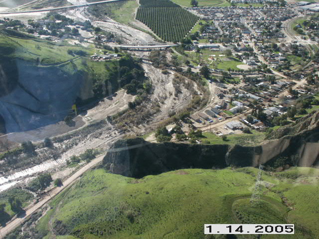
Aerial view of Piru Creek and the town of Piru after the January 2005 storms.
VCWPD photo.
Gages
The main gage used for monitoring spills from Lake Piru is gage 792. This gage has both satellite (GEOS) and ALERT radio paths. The gage is a bubbler system operated by the US Geological Survey. The bubbler has three orifices to accurately measure the lake elevation when dry, half full and full. The orifices have to be changed manually. There are no stream gages on Real-Warring.
Normal Conditions Procedure
Gages Used: 792
|
Criteria |
Value |
Issue |
Area |
Procedure |
|
Flow |
10,000 cfs |
Erosion and Flooding |
220-2 |
Watch for erosion along Piru Creek and for the potential for debris to start collecting on the railroad bridge. |
|
Flow |
12,000 cfs |
Erosion and Flooding |
220-2 |
Warning for potential of flooding along Piru Creek if debris is collecting on the railroad bridge reducing capacity. |
|
Flow |
15,000 cfs |
Erosion and Flooding |
220-2 |
High probability of flooding in Piru due to debris collecting on railroad bridge. Potential for bank erosion along the creek may impact some homes. |
|
Flow |
25,000 cfs |
Flooding |
220-2 |
Flooding of town of Piru even if there are no debris collecting on the railraod bridge. |
Gages Used: None
|
Criteria |
Value |
Issue |
Area |
Procedure |
|
Flow |
1,050 cfs |
Flooding |
228 |
Watch for the potential of debris to collect on road crossing on Real and Warring Drains |
|
Flow |
1,250 cfs |
Flooding |
228 |
Warning for the potential of debris to collect on road crossing on Real and Warring Drains |
|
Flow |
1,500 cfs |
Flooding |
228 |
High probability that water may be flooding parts of the area due to debris caught along bridges especially the railroad bridge and Real/Warring confluence. Flooding should be localized. |
Data collected information provided during the Jan. 2005 flood coordination meeting.